PAGASA Says Tropical Storm Nando to Affect PH Weather Condition
PAGASA LATEST UPDATE – The state weather bureau reported that Tropical Storm Nando will bring rain over parts of the country.
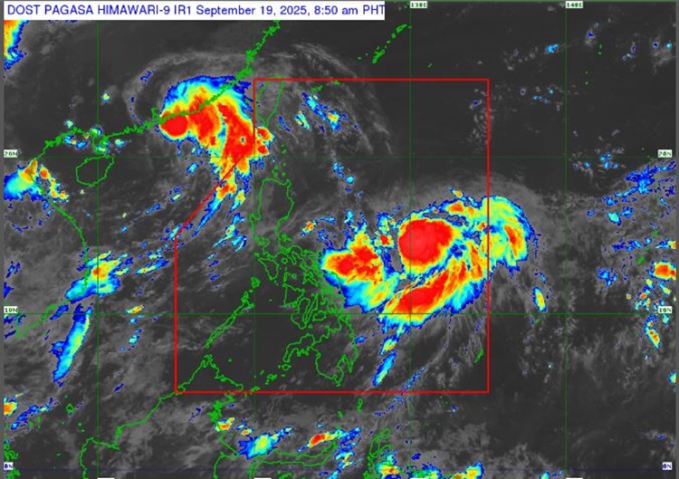
On Friday (September 19, 2025), the Philippine Atmospheric, Geophysical, and Astronomical Services Administration released the latest weather update in the country. Tropical Storm Nando will affect the country’s weather conditions.
PAGASA reported that Tropical Storm Nando has further gained strength, packing maximum sustained winds of 75 kilometers per hour and gustiness of up to 90 kph, moving west northwestward at 15 kph.

“Nando will continue to intensify over the Philippine Sea and may reach typhoon category by tomorrow evening,” Pagasa said.
Nando was last spotted 1,075 km east of Central Luzon, but it is not expected to directly affect the weather in the country.
The tropical storm and habagat will bring heavy rains over Ilocos Region, Zambales, Bataan, Bicol Region, and Eastern Visayas.
“Wind Signal No. 1 will be hoisted over Northern Luzon as early as tomorrow (September 20), and the highest Wind Signal that may be hoisted throughout its passage is Wind Signal No. 5, considering that this tropical cyclone has a possibility to reach super typhoon category,” PAGASA explained.
The weather systems will bring rain over the Bicol Region, Eastern Visayas, and Caraga on Saturday (September 20). Bicol Region, Eastern Visayas, and Caraga will also be affected on Sunday (September 21).
The storm may pass close or may make landfall over the Babuyan Islands from Monday evening (September 22) until Tuesday morning (September 23).
Nando is set to leave the Philippine Area of Responsibility by Tuesday afternoon or evening.
The weather agency advised the public to take precautionary measures for possible flash floods or landslides due to moderate to at times, heavy rains and severe thunderstorms.
RELATED ARTICLE: PAGASA Releases Latest Weather Update for Thursday (September 18, 2025)