PAGASA – Sarah Turns To Tropical Depression As It Exits PAR
PAGASA – Tropical Cyclone Sarah weakened into a tropical depression early Saturday as it comes close to exiting the Philippine Area of Responsibility (PAR).
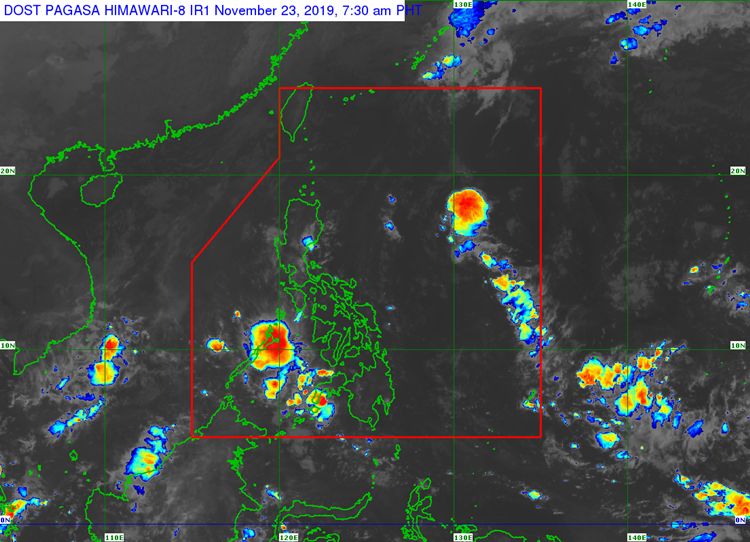
According to the Philippine Atmospheric, Geophysical, and Astronomical Services Administration (PAGASA), the cyclone is now bringing max sustained winds of 55 kilometers per hour (kph) and gusts up to 70 kph.
Adding to this, PAGASA reported that Sarah is forecast to exit PAR in the next 6 hours. Also, it was last seen 700 kilometers northeast of Basco, Batanes or the northern boundary of PAR as of 4:00 a.m.
The weather bureau also said that Sarah could weaken into a low-pressure area (LPA) before it reaches the PAR. With this, gale warnings across the Philippines were lifted.
This is due to the weakening of the northeast monsoon or amihan. However, the monsoon would still bring cloudy skies and isolated rains throughout areas of Aurora and Quezon.
Along with them, the following areas may also experience partly cloudy to cloudy skies with isolated light rains:
- Ilocos Region
- Cordillera Administrative Region
- Cagayan Valley
Thanks for reading. We aim to provide our readers with the freshest and most in-demand content. Come back next time for the latest news here on Philnews.
Like this article? READ ALSO: PAGASA Releases Latest Weather Updates for Saturday (Nov 23)