PAGASA – Bulaoi Rapidly Enhances, Less Likely To Make Landfall
PAGASA – Weather bureau PAGASA recently said that typhoon Bulaoi has rapidly intensified and developed an eye and extreme thunderstorms.
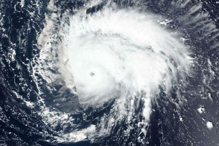
The bureau further said that it is currently stirring over the Pasific Ocean. First spotted as a depression on October 19 (Saturday), it formed into a typhoon on October 20 (Sunday).
According to ABS-CBN, it is less likely to enter the Philippine Area of Responsibilty, hence, less likely to make landfall.
The typhoon is predicted to move towards southern Japan, according to Lorie Dela Cruz, weather specialist.
Bulaoi is currently packed with maximum sustained winds of 110 kilometers per hour and gustiness of up to 135 kilometers per hour. It was last seen at about 2,575 east of northern Luzon.
As per the report, the bureau said that meanwhile, the northeasterly surface windflow is recently prevailing over Luzon.
For Metro Manila and the rest of the country, they will face partly cloudy to cloudy skies with isolated rain due to localized thunderstorms.
What do you think about this? How will you react to this? Let us know more about it.
Check out our latest news at philnews.ph