PAGASA – Liwayway Exiting PAR, New Low Pressure Area Enters
PAGASA – Weather bureau PAGASA recently said that a new low pressure area (LPA) near Surigao enters the Philippine area of responsibility.
It has been previously told that once it becomes a tropical storm, it will be given the name “Marilyn”.
According to ABS-CBN, the low pressure area, which was previously spotted at 1, 050 kilometers east northeast of Mindanao, was currently spotted 915 kilometers east northeast of the municipality of Hinatuan, Surigao Del Sur, according to weather specialist Gener Quitlong.
Quitlong further said that it is unlikely to develop into a tropical depression in the next few days. He, however, said that the LPA’s trough, will bring rains over the following areas:
- Caraga Region
- Northern Mindanao
- Davao Region
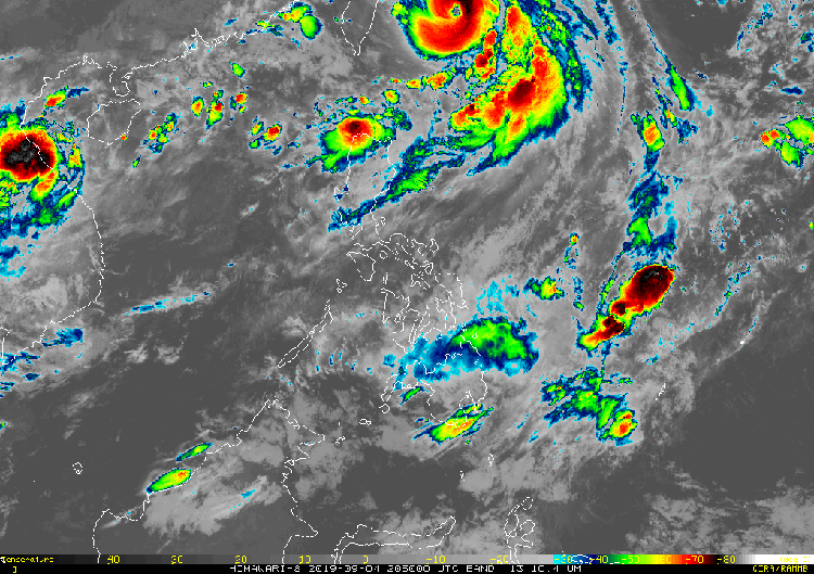
On the other hand, tropical storm Liwayway, now internationally called Lingling, slowly exits the Philippine area of responsibility while it continues to intensify.
Liwayway is currently packed with maximum sustained winds of 155 kilometers per hour and gustiness of up to 190 kilometers per hour.
As it moves north at 10 kilometers per hour, it is predicted to leave the Philippines at Thursday evening. It was last seen 505 kilometers east of the municipality of Basco, Batanes.
As per the report, meanwhile, the following areas will be affected by the southwest monsoon or habagat:
- West part of North Luzon
- Ilocos Region
- Cordillera Administrative Region
- Batanes
- Babuyan Group of Islands
As for the capital and the rest of the Philippines, they will face partly cloudy to cloudy skies, followed up with isolated rains due to localized thunderstorms.
What do you think? How will you react to this? Let us know more about it.