New Tropical Cyclone To Enter PH As Typhoon Paeng Exits PAR
A new tropical cyclone was expected to enter the Philippines next week as Typhoon Paeng leaves the Philippine Area of Responsibility (PAR).
On Saturday (September 29, 2018), the Philippine Atmospheric, Geophysical and Astronomical Services Administration (PAGASA) released the latest weather updates in the country.
PAGASA reported that Typhoon Paeng leaves PAR but will continue to bring very rough seas over the northern and eastern seaboards of Luzon.
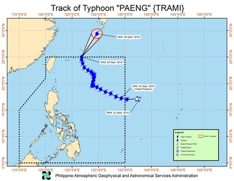
Paeng was last spotted at 730 kilometers northeast of Basco, Batanes with maximum sustained winds of 160 kilometers per hour (kph) and gustiness of up to 195 kph moving 12 kph north.
The weather agency also reported that another tropical cyclone could enter the country’s territory next week, probably on Tuesday (October 2, 2018).
The cyclone was located at 2,245 kilometers east-northeast of the Visayas moving 40 kph at a northwest direction.
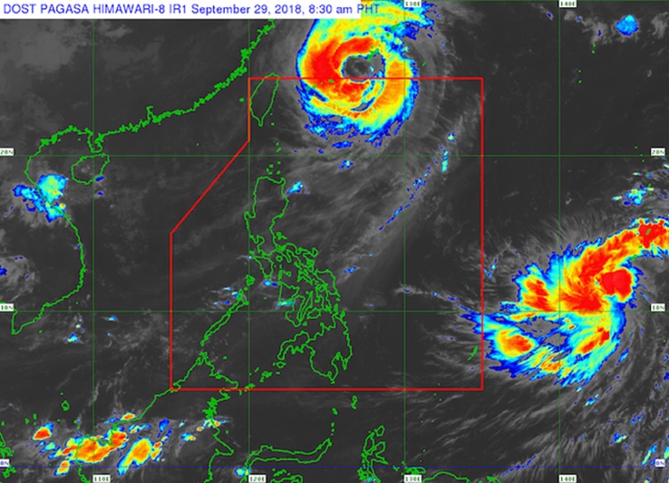
The weather disturbance has slightly intensified packing maximum sustained winds of 60 kph and gustiness of 75 kph.
The tropical depression would be locally named “Queenie”, the 17th cyclone to hit the country if it enters PAR.
The weather bureau also warned the public to take precautionary measures for possible flashfloods and landslides due to localized thunderstorms that might bring heavy rains.
What can you say about this? Just feel free to leave your comments and reactions to this article.