Typhoon Paeng Latest Updates Released By PAGASA
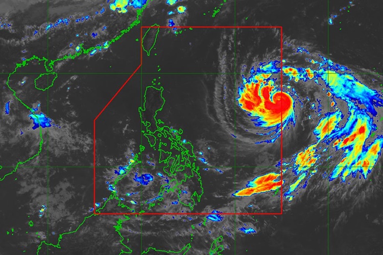
The state weather bureau PAGASA has released the latest weather updates about Typhoon Paeng affecting the country’s weather condition.
On Monday (September 24, 2018), the Philippine Atmospheric, Geophysical and Astronomical Services Administration (PAGASA) give the latest updates about Typhoon Paeng with an international named Trami.
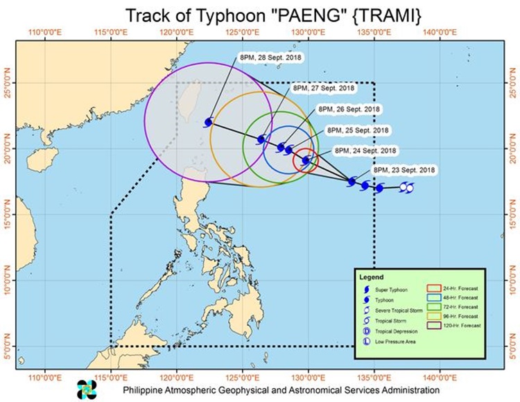
Trami has entered the Philippine Area of Responsibility (PAR) on Sunday (September 24, 2018) and last spotted at 1,100 kilometers east of Tuguegarao City, Cagayan, which is expected the hit extreme Northern Luzon.

Paeng has maximum sustained winds of 170 kilometers per hour (kph) and gustiness of up to 210 kph moving 20 kph at a west direction.
PAGASA explained that the typhoon has no direct effect on any part of the country but expected to enhance the southwest monsoon.
Weather specialist Ariel Rojas said that the country would have a fair weather condition despite the typhoon but localized thunderstorms are expected in the afternoon.

On Friday (September 2018), Typhoon Paeng was expected to affect the weather over Batanes and the Babuyan Group of Islands.
As of now, the weather agency has not yet raised storm warning signals in any parts of the country.
The typhoon was expected to leave PAR on Saturday (September 29, 2018) and predicted to make a landfall near Taiwan.
What can you say about this? Just feel free to leave your comments and reactions to this article.
