Weather bureau PAGASA Expects New Storm (Paeng) If LPA Enters PAR
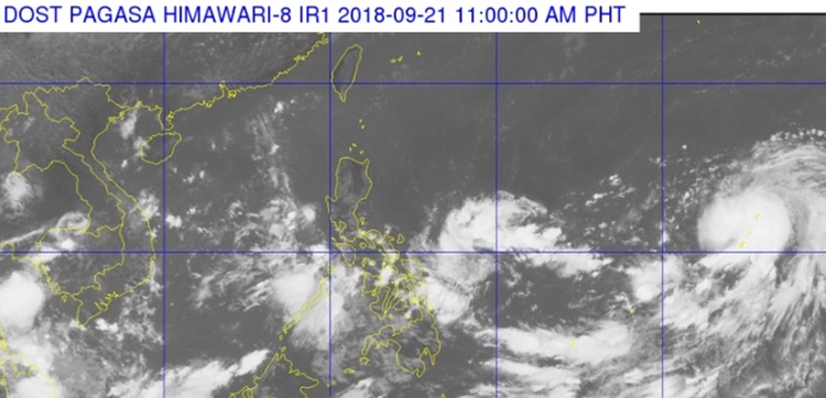
The state weather bureau PAGASA was expecting a new storm that will be named “Paeng” if the low-pressure area enters PAR this weekend.
On Friday (September 21, 2018), the Philippine Atmospheric, Geophysical and Astronomical Services Administration (PAGASA) released the latest weather updates in the country.
PAGASA reported that the low-pressure area spotted east northeast of Hinatuan, Surigao del Sur was expected to intensify as a tropical depression.

However, the Joint Typhoon Warning Center of America already considers the weather disturbance in the Pacific Ocean as a tropical depression.
The LPA will be locally named “Paeng” if it intensifies into a tropical depression and entered the Philippine Area of Responsibility (PAR).
The US Joint Typhoon Warning Center was not expecting the weather disturbance to make a landfall in the Philippines but its direction could still change.

The possible tropical depression could have maximum sustained winds of 90 to 110 kilometers per hour (kph) and gustiness of up to 115 to 185 kph.
What can you say about this? Just feel free to leave your comments and reactions to this article.
