PAGASA: Another Low-Pressure Area Expected To Turn Into Typhoon During Weekend
The state weather bureau PAGASA is now closely monitoring another low-pressure area, which is expected to turn into a typhoon during the weekend.
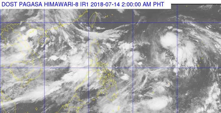
On Saturday (July 14, 2018), the Philippine Atmospheric, Geophysical and Astronomical Services Administration (PAGASA) reported that another low-pressure area was expected to enter the Philippine Area of Responsibility (PAR).
The weather disturbance was located about 1,970 kilometers east of northern Luzon and has a chance to intensify into a typhoon.
PAGASA said that the trough of the LPA enhances the southwest monsoon or locally known as ‘Habagat’ would bring rains over western Visayas, Palawan, Mindoro, Zambales, Bataan, Cavite, and Batangas.
The weather agency also warned the residents in the affected area to take precautionary measures for possible flashfloods and landslides.
The coastal water over northern and central Luzon would have moderate to occasional rough waters due to occasionally strong winds.
Meanwhile, another LPA has already entered PAR but has a slim chance to strengthen into a typhoon. It was last located 500 kilometers east of Guiauan, Eastern Samar.
What can you say about this? Just feel free to leave your comments and reactions to this article.