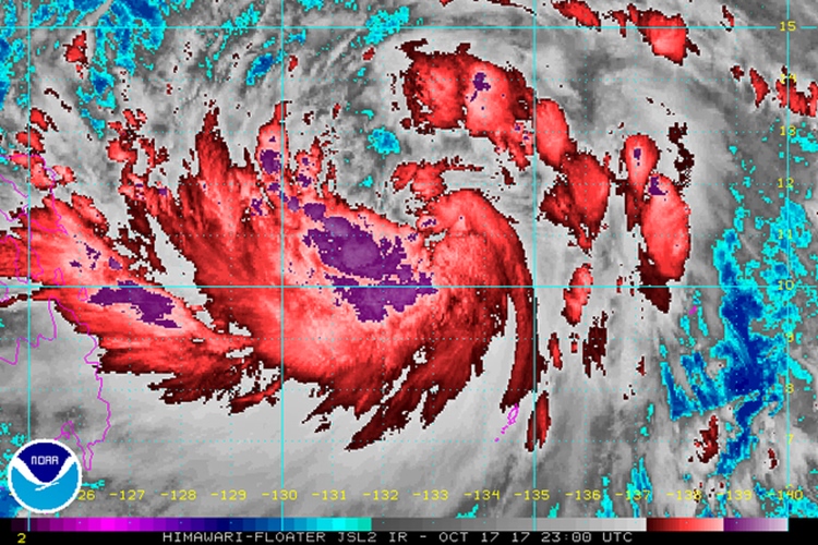
The Severe Tropical Storm Paolo strengthens into a typhoon.
PAOLO – The Severe Tropical Storm Paolo intensified into a Typhoon early Wednesday morning, October 18, says state weather bureau PAGASA.

(Photo lifted from Rappler)
On a previous article as per the 11:00 AM of 17 October 2017 of the Philippine Atmospheric, Geophysical and Astronomical Services Administration (PAGASA), ‘Bagyong Paolo’ with an international name Lan has intensified to a severe tropical storm as it continued to move over the Philippine Sea.
And now, at early morning of 18 October 2017, according to PAGASA’s public weather forecast issued at 4:00 AM, Paolo has strengthened into a typhoon.

(Photo lifted from Rappler)
Based on the report of Senior Weather Specialist Chris Perez, Typhoon Paolo has now maximum winds of 120 kilometers per hour (km/h) and gustiness of up to 145 km/h.
The typhoon is already at 765 kilometers east of Guiuan, Eastern Samar or 745 kilometers east northeast of Hinatuan, Surigao del Sur.
And it is moving north-northwest at a slightly faster 17 km/h from the previous 15 km/h.
Since Paolo is far from land, there are no areas under tropical cyclone warning signals.
Also, it is not expected to make a landfall in the country.
Light to heavy rain to Metro Manila, Calabarzon, Bicol, Oriental Mindoro, Occidental Mindoro, Marinduque, Romblon, Aurora, the Visayas, and Mindanao brought by the outer rainbands of the typhoon.
Meanwhile, state weather bureau PAGASA is also monitoring a low-pressure area (LPA) to which accordingly has a slim chance to be developed into a tropical cyclone.
The LPA is already 260 kilometers west-northwest of Puerto Princesa City, Palawan that will be bringing light to heavy rain to the province.
The rest areas of Luzon will be experiencing isolated thunderstorms.
The state weather bureau warned that the country’s coastal waters are moderate to rough.
What can you say about this?
Watch full report below:
Read also the previous article: Kapamilya Actor Daniel Matsunaga Has New “Girlfriend”?
