Tropical Depression “Fabian” Intensifies As It Enters The Philippine Area of Responsibility
PAGASA announced that the tropical depression “Fabian” intensifies as it enters the Philippine Area of Responsibility (PAR).
On Saturday (July 22, 2017), the Philippine Atmospheric Geophysical and Astronomical Services Administration (PAGASA) has stated on their bulletin that the low pressure area near PAR has already turned into a tropical depression.
The weather bureau said that tropical depression “Fabian” slightly intensifies as it enters the Philippines area of Responsibility and now is in the province of Basco Batanes.
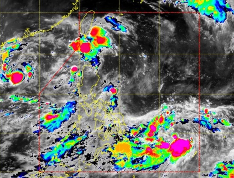
“Fabian” was the sixth cyclone that enters the country as it was located by the weather bureau around 7:00 am on Saturday. The tropical depression was located at 45 km West Southwest of Basco, Batanes (20.3°N, 121.6°E).
Bagyong Fabian has maximum winds of up to 55 kilometer per hour (kph) near the center and gustiness of up to 65 kph. PAGASA forecast that the cyclone will move West Northwest at 18 kph.
The cyclone was expected to exit PAR about 445 km West Northwest of Basco, Batanes on Sunday (July 23, 2017). On Monday (July 24, 2017), it is expected to move 915 km West Northwest of Basco, Batanes.

Meanwhile, some areas in Luzon including Batanes, North Cagayan, and Babuyan Group of islands was declared under Signal No. 1. Moderate up to heavy rain is expected within the 300 km diameter of Fabian.
What can you say about tropical depression “Fabian”? Just feel free to leave your comments and reactions for this article.