Auring is the first weather disturbance to enter the Philippines in 2017
Tropical depression Auring, the first cyclone to enter the Philippine Area of Responsibility (PAR) in 2017, has made its landfall on Siargao island in the province of Surigao del Norte shortly before 5:30, January 8, Sunday afternoon.
Upon landfall, Auring carried with it maximum sustained winds of 55 kilometers per hour and gusts up to 70 kilometers per hour while moving in the direction northwest at nine kilometers per hour.
Auring’s smacking Siargao has sent thousands of residents to higher ground amid warning of landslides and flash floods.
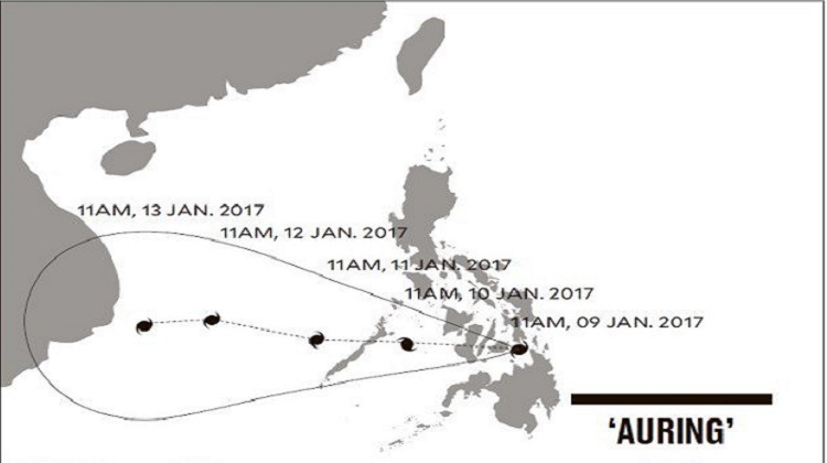
According to Philippine state weather agency, Philippine Atmospheric, Geophysical and Astronomical Services Administration (PAGASA), Auring is forecast to cross the regions of Caraga and Northern Mindanao, Leyte Island and the Central Visayas region on January 9, Monday.
At 4:45 on Monday morning, Auring has made its second landfall iver Ubay, in the province of Bohol.
It is forecast to move toward and reach Palawan on Tuesday and continue to move westward to the West Philippine Sea, where it is expected to exit from PAR on Thursday.
PAGASA expects Auring to remain a tropical depression over land and may intensify to a tropical storm by the time it exits the landmass of Mindanao into the Moro Gulf while it moves towards Palawan.
According to PAGASA Administrator Vicente Malano, while the wind is not destructive, officials have to watch out the heavy rains Auring is bringing.
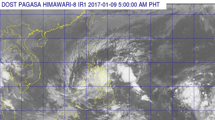
The weather bureau said that the Eastern and Central Visayas and most part of Mindanao were already experiencing heavy rains and according to Malano, Auring could cause flash floods along Davao, Agusan, Tagum-Libuganon and Mindanao river basins.
There are some areas in the Visayas and Mindanao that are most likely to experience landslides, particularly in Caraga, due to mining.
The Mines and Geosciences Bureau (MGB) explained that landslides occur in the place even if there is not heavy raining because of the operation of mining firms.
“The rains may trigger landslides due to the many excavations”, Malano said.
According to the latest weather bulletin by PAGASA, places put under tropical cyclone warning signal no. 1 include Cuyo Island in Luzon; Bohol, Siquijor, Negros Occidental, Negros Oriental, Southern Leyte, Cebu, including Camotes Island, Guimaras, Capiz, Iloilo and Southern part of Antique in Visayas; and Agusan del Norte, Surigao del Norte including Siargao Island, Dinagat Province, Misamis Oriental, and Camiguin in Mindanao.
The National Disaster Risk Reduction and Management Council (NDRRMC) operations center at Camp Aguinaldo went on blue alert since Sunday.