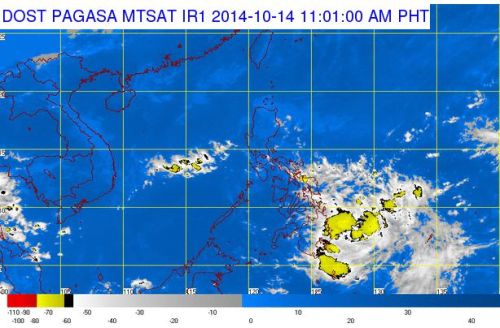
The country’s weather bureau, Philippine Atmospheric, Geophysical and Astronomical Services Administration (PAGASA) reported on Tuesday, October 14, 2014 that a Low Pressure Area (LPA) is expected to enter the Philippine Area of Responsibility (PAR) in 24 hours. The LPA was spotted 1,220 kilometers east of Mindanao as of 4:00 AM.
According to PAGASA weather forecaster Gener Quitlong, in an interview with dzMM, he noted that there are no indications yet that the LPA will intensify into a cyclone but once it will become one, the weather agency stated that it will be locally codenamed “Paeng.”
The newest weather disturbance threatens Mindanao according to PAGASA, the same area which was recently battered by strong rains brought by the inter-tropical convergence zone (ITCZ).
PAGASA noted further that the areas in Mindanao, CALABARZON and the province of Aurora in Luzon will have cloudy skies with light to moderate rains and thunderstorms.
The areas of Cagayan Valley, Cordillera Administrative Region (CAR) and the Ilocos Provinces will have partly cloudy to cloudy skies with isolated light rains. The Metro Manila areas and the rest of the country will be partly cloudy to cloudy with isolated rains or thunderstorms.
PAGASA also stated that wind will be moderate to strong from northeast over Luzon, and from the east to northeast over the Eastern section of the Visayas and Mindanao. All coastal waters with the above-mentioned areas will be moderate to rough.

