
PAGASA Monitors Possible Return of Typhoon ‘Uwan’
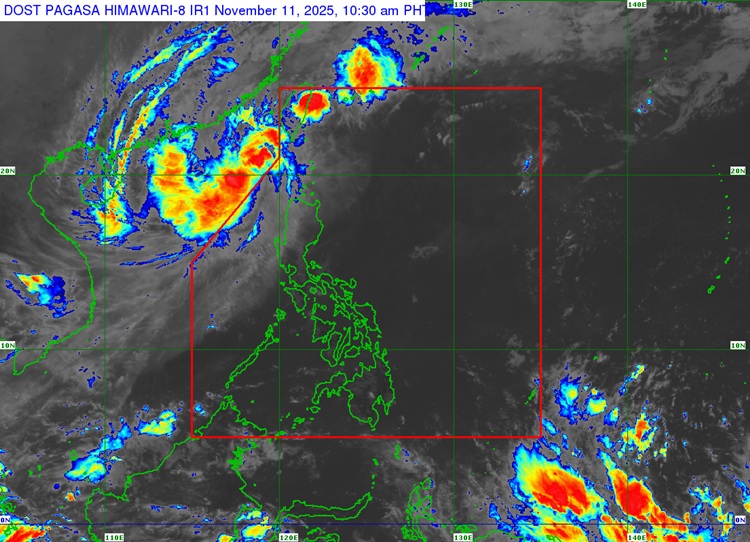
TYPHOON UWAN – While residents in northern Luzon are still feeling Uwan’s strong winds and rough seas, PAGASA cautions that the typhoon could return midweek following a northward then northeastward track.
Typhoon Uwan has exited the Philippine Area of Responsibility (PAR) but continues to influence weather conditions in parts of northern Luzon, according to the Philippine Atmospheric, Geophysical and Astronomical Services Administration (PAGASA). Tropical cyclone wind alerts remain raised in several provinces as the storm maintains its strength while moving northward.
As of 4 a.m. Tuesday, PAGASA reported that the typhoon’s center was spotted 365 kilometers west of Calayan, Cagayan, moving north at 15 kilometers per hour (kph). Uwan continues to carry maximum sustained winds of 120 kph and gusts reaching up to 150 kph, producing powerful winds and turbulent seas across wide areas of Luzon.

“Uwan is now outside the Philippine Area of Responsibility and will follow a recurving path turning northward then northeastward for most of the forecast period,” PAGASA said. However, the agency noted that the system could re-enter PAR by Wednesday evening as it nears Taiwan’s southwestern coast, where it is expected to weaken further after landfall.
Ongoing Wind Signals
Tropical Cyclone Wind Signal (TCWS) No. 2, signifying strong to gale-force winds, remains in effect over Batanes, Cagayan, including Babuyan Islands, Apayao, Abra, and Kalinga, as well as the western areas of Mountain Province such as Besao, Sagada, and Bontoc. It is also hoisted over northwestern Benguet, Ilocos Norte, Ilocos Sur, and the northern part of La Union, including Luna, Santol, and San Fernando City.
Meanwhile, TCWS No. 1 is still up in Isabela, Quirino, Nueva Vizcaya, Pangasinan, Aurora, Nueva Ecija, Zambales, Bataan, Bulacan, Metro Manila, Cavite, Laguna, Rizal, northern Quezon (including Polillo Islands), and Lubang Islands. PAGASA advised residents in these locations to prepare for occasional gusts and light to moderate rains.
Gale Warning and Rough Seas
A gale warning has also been raised across the seaboards of Northern Luzon and the western coastlines of Central and Southern Luzon, where sea travel remains dangerous for all types of vessels. Small boats and fishing vessels are particularly advised to stay ashore due to the risk of rough to very rough sea conditions.
Wave heights may reach up to 3.5 meters along the coasts of Aurora, Occidental Mindoro, and Palawan (including the Calamian Islands), while up to 3 meters are expected along Bataan, Cavite, Batangas, Metro Manila, Pampanga, and Bulacan. Moderate to rough seas reaching 2.5 meters are also forecast along Catanduanes, Camarines provinces, Northern Samar, Albay, and Sorsogon.
Even outside PAR, Uwan continues to intensify the northeast monsoon or “amihan,” which may bring cooler weather, cloudy skies, and occasional light rains over several parts of Luzon in the coming days.
READ ALSO: Toni Gonzaga Shares Heartfelt Prayer For The Country Due To Typhoon Uwan