PAGASA – Kristine Unlikely To Affect PH (September 4, 2020)
PAGASA – Weather bureua PAGASA said that Typhoon Kristine is unlikely to have any influence in the nation’s climate despite enteriing PAR.
The bureau said, however, that Kristine (internationally called Haishen) will bring rough to very rough sea conditions on Friday night or Saturday morning in the northern and eastern seaboards of Northern Luzon.
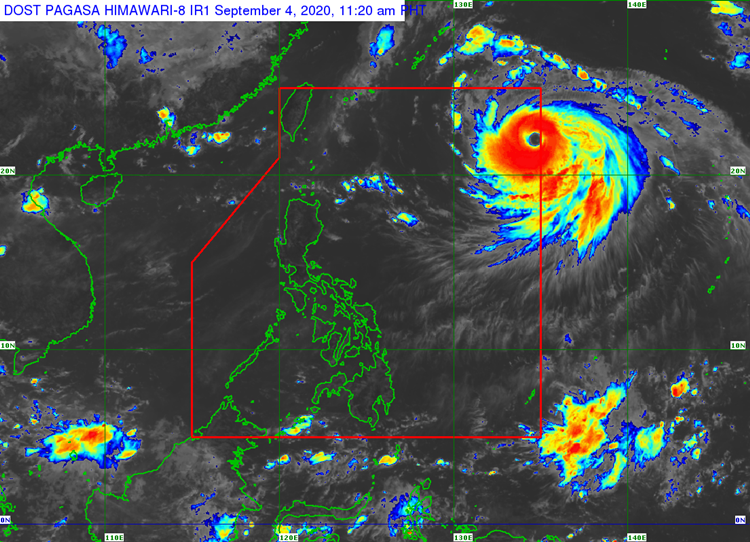
According to Inquirer, the bureau said that the weather disturbance has entered the Philippine Area of Responsibility (PAR) on 9 AM on Friday. It was last seen at around 1,340 kilometers east of extreme Northern Luzon.
Kristine is packed with maximum sustained winds of 185 kilometers per hour and gusts of up to 230 kilometers per hour. It is moving northwestward at 15 kilometers per hour
The typhoon will remain far from landmass as it negotiates the west-northwestward and northwestward track while it is inside PAR, which is expected to leave from at Saturday evening or Sunday morning.
Based on the report, the bureau did not raise any Tropical Cyclone Warning Signal (TCWS) as of the moment.
For the wind speed forecast, northern and central Luzon will have light to moderate winds that are moving in the northwest to west direction while facing slight to moderate coastal waters.
Visayas and the rest of Luzon will have light to moderate winds that are moving southwestward while facing slight to moderate coastal waters.
Mindanao will have light to moderate winds that are moving in the southeast to southwest direction while facing slight to moderate coastal waters.
What do you think of this report? How will you react to this? Let us know more about it in the comments below.
Check out our latest news at philnews.ph or in our following social media pages
Facebook: /PhilNews
Twitter: @PhilNews247
Instagram: @philnewsph