PAGASA – Ursula Moves Away PAR, North Luzon To Face Rains
PAGASA – Weather bureau PAGASA recently said that Typhoon Ursula continues to move further away from the Philippine Area of Responsibility.
The weather bureau said, however, that Northern Luzon will face rains due to the tail end of a cold front.
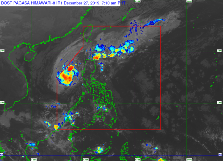
According to Inquirer, in their bulletin, the typhoon, internationally called Phanfone, was last seen at about 335 kilometers west of Subic town, Zambales as of 3 AM.
It is currently packed with maximum sustained winds of about 120 kilometers per hour and gusts of up to 150 kilometers per hour. It is heading northwest at about 10 kilometers per hour.
Based on the report, cloudy skies with scattered rains and isolated thunderstorms that is caused by the tail end of a cold front will be faced by Ilocos Region, the Cordillera Administrative Region, Cagayan Valley, and Aurora.
The bureau further warned residents of the aforementioned areas to take precautionary measures against flash floods and landslides that might occur during severe thunderstorms.
The bureau also lifted all tropical cyclone wind signals in the Philippines. Ursula is set to leave the Philippine Area of Responsibility (PAR) on Saturday morning.
What do you think? How will you react to this? Let us know more about it.
Check out our latest news on philnews.ph