Typhoon Quiel Exits PAR, Tail-End of Cold Front To Affect Parts of PH, PAGASA Says
The state weather bureau PAGASA announced that Typhoon Quiel exited the Philippine Area of Responsibility while the tail-end of a cold front would affect parts of the country.
On Saturday (November 9, 2019), the Philippine Atmospheric, Geophysical and Astronomical Services Administration released the latest weather updates in the country. PAGASA said that Typhoon Quiel leaves the country’s vicinity.
PAGASA said that Quiel was last spotted at 560 kilometers west of Coron, Palawan and continue to move away from the Philippines. The typhoon has maximum sustained winds of 120 kilometers per hour and gustiness of up to 150 kph.
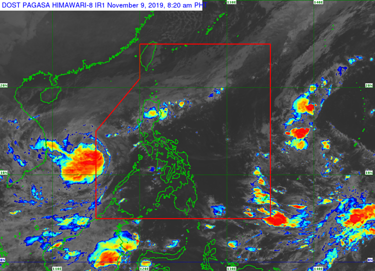
The weather agency said that the tail end of a cold front would bring cloudy weather conditions with scattered rainshowers and thunderstorms over Ilocos Region, Cordillera Administrative Region, and Cagayan Valley.
The localized thunderstorms would also bring partly cloudy to cloudy conditions with isolated rainshowers over Metro Manila and the rest of the country.
Meanwhile, the coastal water conditions over the western sections of central and southern Luzon would be rough. The rest of Luzon and the Visayas would have moderate waters.

Slight to moderate surrounding sea conditions are expected over the region of Mindanao, according to the weather bureau.
What can you say about this? Just feel free to leave your comments and reactions to this article.