Bagyo Dindo will bring light to moderate rains and isolated thunderstorms is expected over Western Visayas and the provinces of Zambales, Bataan and Palawan.
Bagyo Dindo maintains his strength as he traverses Northern Luzon on Thursday, August 25.
According to the state weather bureau, Philippine Atmospheric Geophysical and Astronomical Services Administration (PAGASA), the center of the typhoon was last seen, based on all available data, at 1,005 km East Northeast of Itbayat, Batanes.
He maintains wind strength of 165 kph near the center and gustiness of 190 kph.
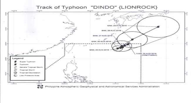
Bagyo Dindo is moving toward Southeast with a speed of seven (7) kilometers per hour.
PAGASA has not issued a tropical cyclone signal warning yet in any part of the country.
However, the weather bureau forecast cloudy skies with light to moderate rains and isolated thunderstorms is expected over Western Visayas and the provinces of Zambales, Bataan and Palawan. Partly cloudy to cloudy skies with isolated rainshowers or thunderstorms will prevail over Metro Manila and the rest of the country.
Moderate to strong winds blowing from the southwest will prevail throughout the archipelago and its coastal waters will be moderate to rough.
As defined by the Puerto Galera Yacht Club, habagat season is characterized by hot and humid weather, frequent heavy rainfall, and a prevailing wind from the west. The main indicator of the switch between the amihan and habagat seasonal patterns is the switch in wind direction.
Habagat, or the Summer Southwest Monsoon weather is characterized by a strong, generally West or southwest breeze that is responsible for bringing significant rainfall to the Asian subcontinent and to South and East Asia. The significant southwest monsoon rainfall is a by-product of air passing over large areas of warm equatorial ocean, stimulating increased levels of evaporation from the ocean’s surface; the southwest monsoon air, now laden with water vapour, cools as it moves north and as it rises over land; at some point the air is no longer able retain its moisture and precipitates copious volumes to irrigate rice fields and drench rainforests, sometimes causing severe flooding below hillsides that have been foolishly stripped of forest cover by Man.
The Summer Monsoon (West or southwest) is the predominant weather pattern from late April through to early October each year, throughout most Asian tropical destinations.