A week after Storm Carina, an LPA is towing the Philippine Area of Responsibility.
On Monday, The Philippine Atmospheric, Geophysical, and Astronomical Services Administration (PAG-ASA) issued general flood advisory to some provinces in Northen Luzon following the sight of a Low Pressure Area (LPA) which brings torrential rains.
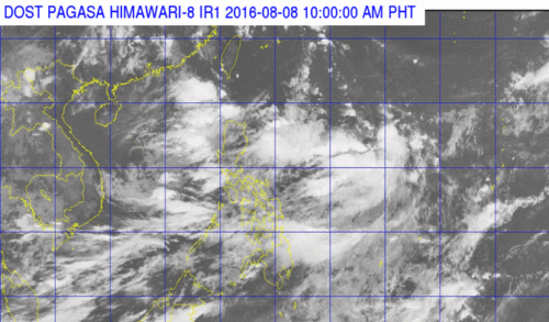
Based on all available data, the LPA was last tracked at 645 km Northeast of Itbayat, Batanes.
Included in the general flood advisory were Ilocos Norte and Ilocos Sur, Cagayan and Aurora.
While in some other parts of the country are affected by the Southwest monsoon.
The national weather bureau forecast that on August 8, cloudy skies with light to moderate rains and thunderstorms will be experienced over Metro Manila and the regions of Ilocos, Cordillera, Cagayan, MIMAROPA, CALABARZON, Western Visayas and the Provinces of Zambales and Bataan. Partly cloudy to cloudy skies with isolated rainshowers or thunderstorms will prevail over the rest of the country.
It was also forecast that moderate to strong winds blowing from the southwest will prevail throughout the entire archipelago and the coastal waters will be moderate to rough.
It has only been almost a week since Tropical Storm Carina has left the Philippines.
Wikipedia explains a low-pressure area, low or depression, as a region where the atmospheric pressure is lower than that of surrounding locations. Low-pressure systems form under areas of wind divergence that occur in the upper levels of the troposphere. The formation process of a low-pressure area is known as cyclogenesis. Within the field of meteorology, atmospheric divergence aloft occurs in two areas. The first area is on the east side of upper troughs, which form half of a Rossby wave within the Westerlies (a trough with large wavelength that extends through the troposphere). A second area of wind divergence aloft occurs ahead of embedded shortwave troughs, which are of smaller wavelength.
Diverging winds aloft ahead of these troughs cause atmospheric lift within the troposphere below, which lowers surface pressures as upward motion partially counteracts the force of gravity.