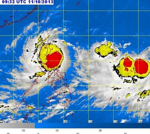
The weather bureau of the Philippines, PAGASA released the latest weather bulletin of the Tropical Cyclone Santi which currently hits most parts of Luzon. The Weather Bulletin was issued at around 5:00 PM, October 11, 2013.
The location of eye or the center of Typhoon Santi was located based on all available data at 150 km East Southeast of Baler, Aurora (15.4°N, 123.1°E) at around 4:00 PM.
Based upon the forecast of PAGASA the Storm Santi will move West at 15 kph. The forecast position of Santi is expected to be in the vicinity of Dagupan City by tomorrow afternoon and at 390 km West of Dagupan City by Sunday afternoon. On Monday, it is expected to be at 730 km West of Dagupan City outside the Philippine Area of Responsibility (PAR).
Here’s the Public Storm Signals of Typhoon Santi:
PSWS #3 (Winds of 101-185 kph is expected in at least 18 hrs): Aurora, Isabela, Quirino, Nueva Vizcaya, Ifugao Benguet, La Union, Ilocos Sur, Pangasinan, Mt. Province, Tarlac, Nueva Ecija, Northern Quezon including Polilio Island and Northern Zambales
PSWS #2 (Winds of 61-100 kph is expected in at least 24 hrs):
Metro Manila, Ilocos Norte, Cagayan, Apayao, Kalinga, Abra, Rest of Zambales, Pampanga, Bataan, Bulacan, Rizal and Rest of Quezon
PSWS # 1 (Winds of 30-60 kph is expected in at least 36 hours):
Calayan and Babuyan Group of Is., Cavite, Batangas, Laguna, Lubang Islands, Marinduque, Camarines Provinces, Northern Mindoro and Catanduanes
Hourly update of Typhoon Santi:


