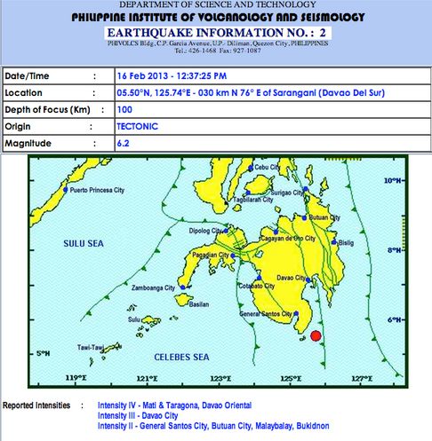
A magnitude 6.2 earthquakes strucked the vicinity of Sarangani Province in Davao del Sur at around 12:37 PM based upon the bulletin posted by the Philippine Institute of Volcanology and Seismology (PhiVolcs) on their official website.
The United States Geological Survey have already confirmed the earthquake that struck the Philippines southern islands. As of this posting there’s no reported damages in the areas affected.
Here’s the earthquake details from USGS:
Location
5.759°N 125.838°E depth=98.2km (61.0mi)
Nearby Cities
- 28km (17mi) SE of Caburan, Philippines
- 65km (40mi) ESE of Malapatan, Philippines
- 68km (42mi) ESE of Lun Pequeno, Philippines
- 70km (43mi) E of Glan, Philippines
- 971km (603mi) W of Koror Town, Palau