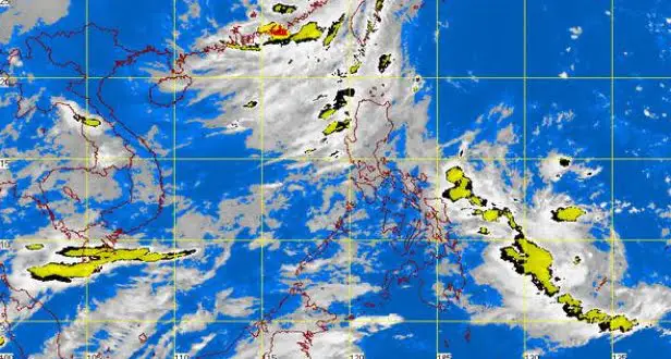
The Low Pressure Area (LPA) Inday which earlier dissipated has re-formed according to the latest weather bulletin released by PAGASA on Thursday, July 24, 2014. The LPA was spotted by PAGASA at 800 kilometers east of Guiuan, Eastern Samar as of 4:00 AM on Thursday.
According to the latest PAGASA bulletin the provinces of Zambales, Bataan, Zamboanga, Metro Manila, Cavite, Batangas, CAR, Mimaropa and the rest of the Ilocos region will experience monsoon rains.
The LPA has a big chance of intensifying into a tropical cyclone according to PAGASA weather forecaster Manny Mendoza. The weather forecaster noted that “Medyo bumaba and kanyang atmospheric pressure. Nagkaroon ng wind convergence from different directions. Kapag bumaba pa ang atmospheric pressure, magiging ganapna itong tropical depression,” Mendoza told dzMM.
PAGASA also noted that the southwest monsoon (habagat) was still affecting Luzon, while the rest of country will be partly cloudy to cloudy with isolated rains or thunderstorms.
If the Low Pressure Area (LPA) will enter the Philippine Area of Responsibility as a Tropical Cyclone, it will be named as Bagyong Inday.
Note: This is a developing story, we will update this post as soon as PAGASA will release an update of the newest tropical weather disturbance to hit the country in the month of July.