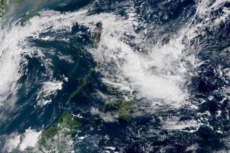
Cyclone May Slam Into Eastern Luzon & Visayas This Week
CYCLONE – A brewing cyclone has come breached the Philippine Area of Responsibility yesterday and may affect areas of Eastern Luzon and Visayas.

A low-pressure area was detected at 3:00 p.m. at 1,025. kilometers east of Virac in Catanduanes. This was according to the Philippine Atmospheric, Geophysical, and Astronomical Services Administration (PAGASA).
According to PAGASA weather forecaster Aldczar Aurelio, the weather system might develop into a tropical cyclone today or tomorrow. He added that it could move closer to Bicol and Eastern Visayas this week.
With this, Loriedin dela Cruz, a PAGASA weather specialist stated that landfall could be a possible scenario. Dela Cruz added that the extension of the LPA has already affected:
- Bicol Region
- Calabarzon
- Cavite
- Laguna
- Batangas
- Rizal
- Quezon
- Aurora Province
Based on an article from Philstar, the weather disturbance is also expected to dump rains over to Metro Manila tomorrow and Thursday.
In the next 24-hours, the developing cyclone will bring light to moderate showers and thunderstorms over the following areas:
- Bicol Region
- Eastern Visayas
- Caraga
- Aurora and Quezon Provinces
Luckily, Northern Luzon will be getting improved weather. This is due to the tail-end of a cold front being weekend.
However, the weather system could still potentially bring dark cloudy skies with light to moderate showers over those areas. The next tropical cyclone to enter the country will be named “Ramon”.
Thanks for reading. We aim to provide our readers with the freshest and most in-demand content. Come back next time for the latest news here on Philnews.
Like this article? READ ALSO: PAGASA – LPA Brings Cloudy Skies, Scattered Rains (November 12)
