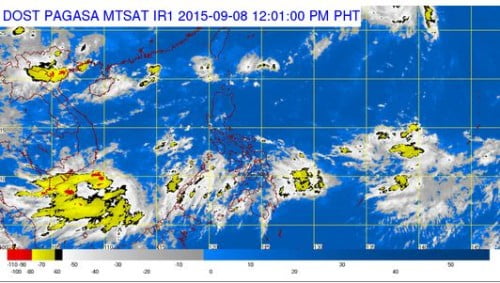
The country’s weather bureau warned the Filipino public that the Southwest Monsoon (Habagat) will be affecting most areas of Southern Philippines particularly in the areas of Palawan, Visayas and Mindanao, while the latest weather disturbance that might enter the country, Tropical Depression “Etau” is still outside the Philippine Area of Responsibility.
According to the latest weather bulletin released by PAGASA on Tuesday morning, September 8, 2015, at around 4:00 AM, the Tropical Depression “Etau” (international name) which will be called Bagyong Jenny once it enters PAR.
Tropical Depression Etau was currently spotted outside the Philippine Area of Responsibility, based upon all available data, TD Etau was at 1,795 km east of extreme northener Luzon with a maximum winds of 55 kph near the center. The latest weather disturbance is forecast to move North Northwest at 15 kph.
PAGASA also noted that Western Visayas, Zamboanga Peninsula, Caraga and Palawan will have cloudy skies with light to moderate rain on Tuesday.
This is due to the southwest monsoon prevailing over Palawan, the Visayas and Mindanao, the Philippine Atmospheric, Geophysical and Astronomical Services Administration said. Partly cloudy to cloudy skies with isolated thunderstorms will prevail over Metro Manila and the rest of the country.

