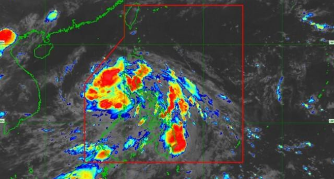
PAGASA Typhoon Butchoy Update – Storm Heading Towards West PH Sea
TYPHOON BUTCHOY – According to the Philippine Atmospheric Geophysical and Astronomical Services Administration (PAGASA), Tropical Depression Butchoy reached Zambales.
Furthermore, Butchoy also headed toward West Philippine Sea this Friday morning. According to PAGASA’s 4:00 AM severe weather update, San Felipe near Zambales was last hit by the center of the storm.
Additionally, the storm was recorded to be moving west north-west with a speed of 15 kilometers per hour. The storm also brings winds 45 kph winds and 75 kph gusts.
As per the report from PAGASA, moderate to heavy rains or intense rains are expected in the following areas:
- Zambales
- Bataan
- Pampanga
- North of Palawan
- Calamian
- Cuyo Islands
- Mindoro Occidental
Meanwhile, light to moderate rains are expected in these areas:
- CALABARZON
- Visayas
- Caraga
- Davao Region
- Other parts of Luzon
The Tropical Cyclone Wind Signal (TCWS) #1 has also been lifted in Metro Manila. Now, the areas under TCWS#1 are as follows:
- Pangasinan
- Zambales
- Bataan
- Tarlac
- Pampanga
- Nueva Ecija
- Bulacan
Areas under Tropical Cyclone Wind Signal #1, Visayas, Southern Luzon and the western portion of Mindanao may experience occasional gusts associated with the tropical depression and the Southwest Monsoon
PAGASA
Check out our latest news at philnews.ph or in our following social media pages
Facebook: /PhilNews
Twitter: @PhilNews247
Instagram: @philnewsph