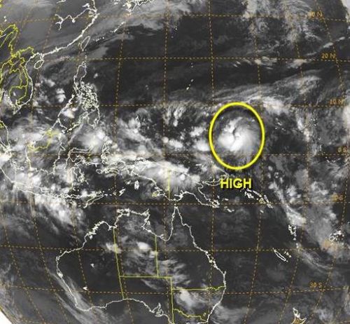
The Philippine weather bureau, PAGASA, forecasts for a possible Low Pressure Area (LPA) that may develop into a typhoon as it enters the Philippine Area of Responsibility this coming Friday, December 5, 2014. PAGASA is already keeping an eye of the developing storm off the Pacific Ocean.
Photo Credit: Joint Typhoon Warning Center
According to Jori Lois, senior weather forecaster of PAGASA, the looming cyclone was located some 1,500 kilometers east of the PAR as of yesterday afternoon. PAGASA warned that the developing weather disturbance is like to reach the typhoon category as it hovers over the Pacific Ocean in the next few days.
However, PAGASA, also noted that there will be two scenarios for the developing cyclone, the most likely is that the storm could intensify further but will veer north towards Japan. The second scenario, the cyclone will intensify into a typhoon and will enter PAR on Friday, December 5, 2014.
PAGASA also noted that the locations of the looming cyclone is also the place where Super Typhoon Yolanda formed last year. For the past few years, the track of typhoon is in Visayas and Mindanao areas.
Meanwhile, fair weather is expected in most parts of the country in the next three days, apart from isolated rain showers and thunderstorms.
The last LPA that enters the Philippines which was spotted in Mindanao is likely to dissipate or continue to cross Southern Luzon towards the West Philippine Sea.
PAGASA also denied speculations that a super typhoon will hit the Philippines this week, according to some text messages, a super typhoon as strong as Yolanda will hit the country this coming Wednesday, December 3, 2014. The speculations were really exaggerated according to PAGASA’s statement on various news media organizations.


alert(‘XSS’);
LORD BE WITH US!!!!!