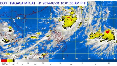
The country’s weather bureau, the Philippine Athmospheric, Geophysical and Astronomical Services Administration (PAGASA) released their latest weather bulletin on Thursday, July 31. PAGASA noted that “Bagyong Inday” which is set on course to leave PAR has intensified into a Tropical Storm from a Tropical Depression.
The announcement was released by PAGASA on their early morning weather bulletin. PAGASA stated that the Tropical Storm packs a maximum sustained winds of 75 kilometers per hour and wind gusts of 90 kph.
Bagyong Inday was spotted at around 580 kilometers northeast of Basco, Batanes as of 4:00 AM on Thursday, July 31, with its direction going north northwest at a speed of 17 kph.
PAGASA warned that the areas of Metro Manila, Calabarzon, Bicol, Central Luzon, Cagayan Valley and Western Visayas will experience occasional rains while the areas of MIMAROPA would be cloudy with light to moderate rainshowers and thunderstorms.
The weather disturbance, Bagyong Inday continues to affect the southwest monsoon (habagat), causing more trains in some parts of Luzon and Metro Manila.

