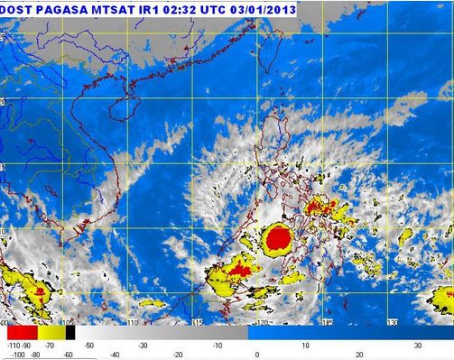
The Philippine Atmospheric, Geophysical and Astronomical Services Administration (PAGASA-DOST) have confirmed that the Low Pressure Area over Northern Mindanao has developed into a tropical depression depression named as “Auring.”
PAG-ASA already issued bulletin #1 at around 11:00 AM, today January 03, 2013. The location of the eye or the center of the Typhoon Auring was estimated based on satellite and surface data at 50 kilometers West of Dipolog City (8.5°N, 122.9°E).
Bagyong Auring has a maximum winds strength of 55 kph near the center. It will move West at 28 kph. The forecast position of the Tropical depression “Auring” is expected to be at the 180 km Southwest of Puerto Princesa City tomorrow morning at 460 km West of Puerto Princesa City by tomorrow evening or outside the Philippine Area of Responsibility (PAR).
The Public Storm Signal no. 1 were raised in areas of Palawan, Southern Part of Negros provinces and Siquijor. Mindanao areas will also experienced Signal no. 1, with winds of 30-60 kph within the next 36 hours.